SpacePort project concludes use of geospatial data can help to solve transport challenges in ports
UK ports face major challenges to reduce carbon emissions and reach net zero objectives. A key aspect of meeting these targets is the reduction of atmospheric emissions from the logistics network that transfers cargo between ships and the wider supply chain. The SpacePort feasibility project, funded by the Geospatial Commission in partnership with Innovate UK, has successfully concluded that a novel geo-spatial data platform with associated technologies and data-enabled solutions can significantly streamline port operations, improve efficiency whilst addressing the decarbonisation and emissions reduction challenges. Additionally SpacePort has identified important safety benefits to port operations. The project has shown how optimisation of port operations beyond Portsmouth International Port could make a significant contribution towards the UKs net-zero freight logistics infrastructure.
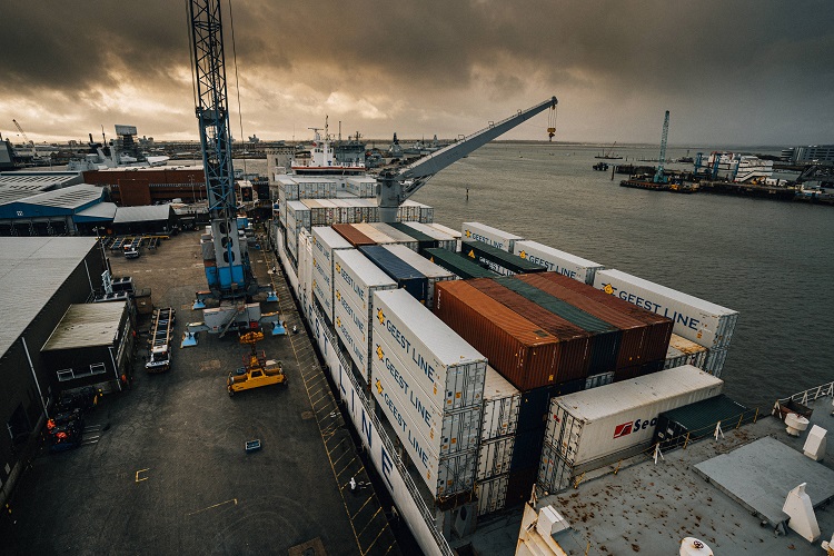
The research project brought together marine sector specialist MSE International, Connected Places Catapult, the UK innovation accelerator for cities, transport and places, Portsmouth International Port, the UKs biggest municipal port, and Portico, who operate two deep-water cargo berths at the port.
The project considered the challenges for the port including; the impact of maritime logistics on the citys air quality; the requirements of the 2050 maritime emissions targets; the congestion in the city centre and surrounding areas and alignment with the citys transport strategy including the Solent Freeport. The project assessed the diverse geo-spatial and other data resources that could offer solutions as well as undertaking a detailed technical appraisal of available geo-spatial solutions. In addition, the ports existing logistics systems were reviewed and a detailed use-case mapping exercise conducted to check that all the data resources and positioning and sensing technologies could deliver the functionality required by the port. This check proved successful.
The feasibility study has successfully developed the geo-spatial data-platform system architecture required for realising many applications including the 6 use case scenarios identified by the project team including: port flow optimisation; container stacking/positioning optimisation; delays early warning system; traffic management around the local consolidation centre; first/last mile optimisation and port safety strategy. The project has successfully concluded that the SpacePort concept can exploit geo-spatial data to offer: Just-in-Time freight delivery and collection from the port with prior custom documentation checks; forecasting of vessel and truck ETAs; optimisation of first and last mile logistics and sufficient value-add to offset the local consolidation centre costs.
The project team worked closely with Portsmouth International Port, Portico and Portsmouth City Council, as well as taking into consideration the Solent Transport Strategy and wider goals of Transport for South East England, to ensure that the solutions meet the needs of the port, its customers and other significant stakeholders in the region.
To be kept up to date with this and related projects please sign up to the MSE Maritime Decarbonisation Interest Group at: https://www.mseinternational.org/interest_groups/